Hualapai Mountain Park Trails

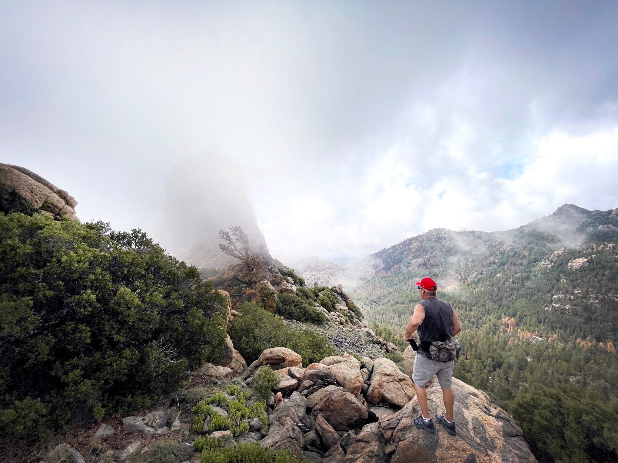
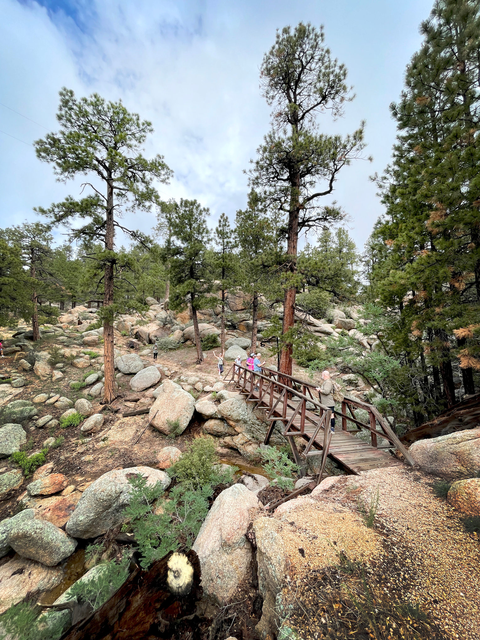
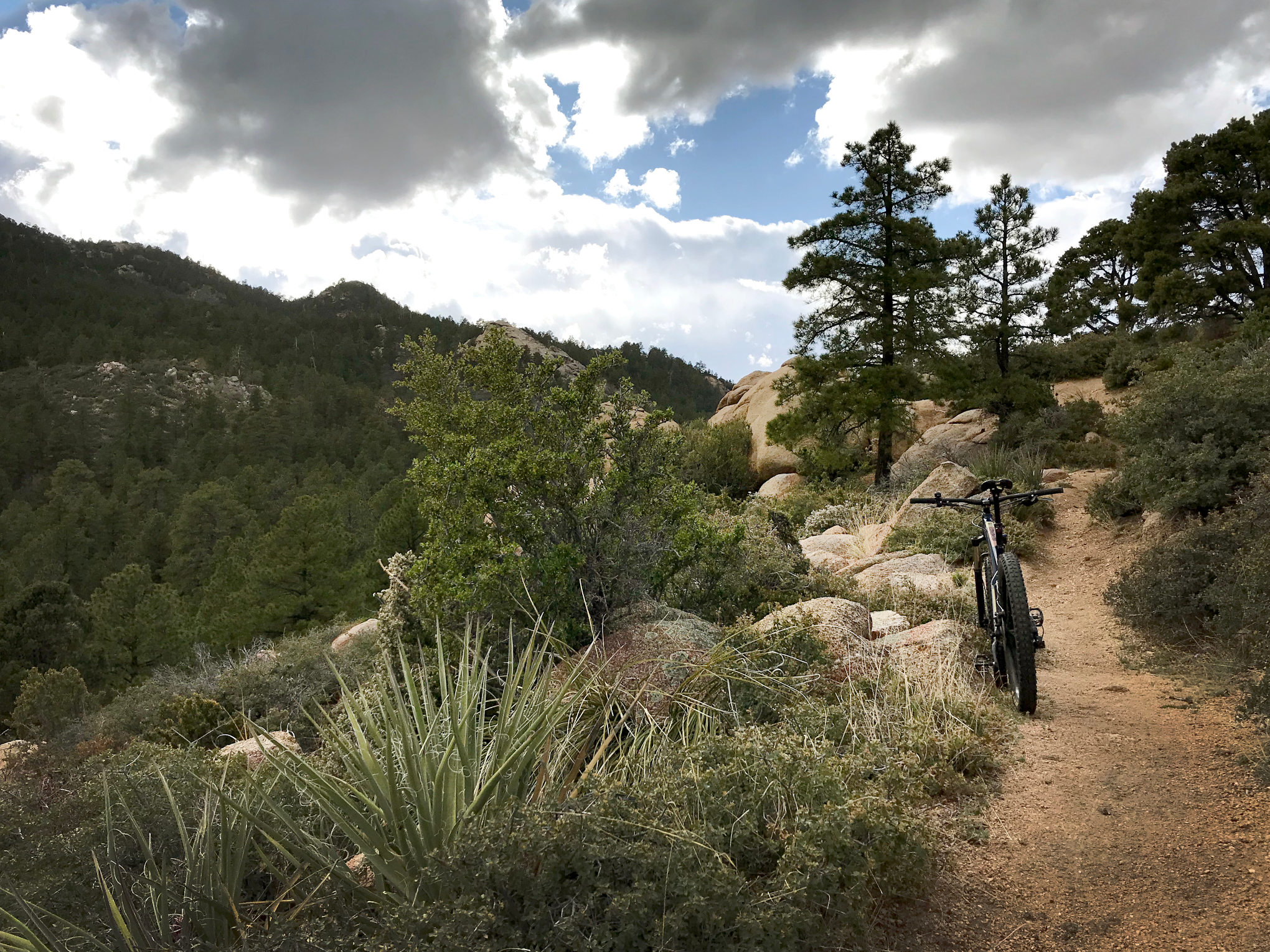
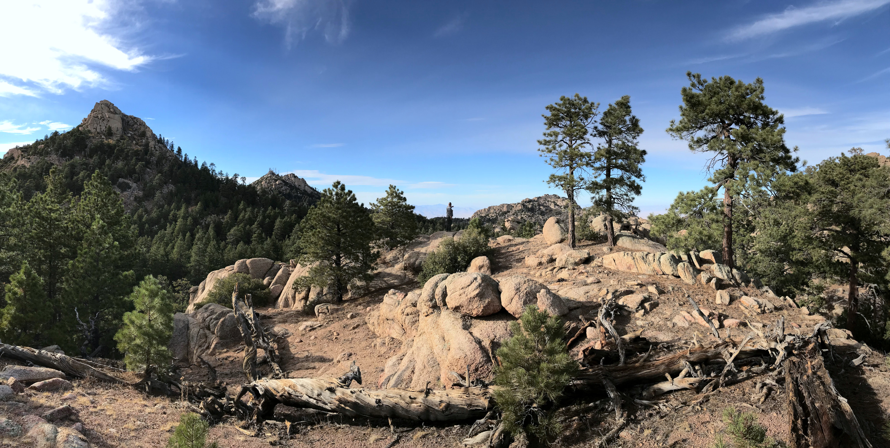
Hualapai Mountain Park offers 10 miles of trails for hikers, mountain bikers and equestrians to enjoy. Situated atop the Hualapai Mountains, the trails provide spectacular views of the desert below and the mountain ranges in the distance. Construction of the trail system began in 1936 as a result of Roosevelt’s New Deal and was completed by the Civilian Conservation Corps. On the trail, users will experience a variety of mountain habitats and have the opportunity to see many species of wildlife. Markers on the trail are numbered to correspond with the information on this website. Remember, be courteous to other trail users and enjoy your visit.
View a map of the Hualapai Mountain Trails
HABITATS FOUND
| Zone | South Slope | North Slope | Waterway (Riparian) |
|---|---|---|---|
| 1. Chaparral | 6,000' | 5,000' | 4,500' |
| 2. Pink/Oak | 7,500' | 6,500' | 5,500' |
| 3. Mixed Conifer | 8,000' | 7,500' | 7,000' |
| 4. Fir/Aspen | 9,500' | 8,000' | 7,500' |
TRAIL FEATURES
Trailhead
Elevation: 6,200'
Habitat: 1
In the summer of 2000, one mile of new trail was added to this location. A parking area, restroom, and a picnic area are located a short distance down the road to the north, cross the bridge and turn north. You are in Sawmill Canyon, which is a riparian area in which Arizona Walnut, Canyon Maple, Southwestern Black Cherry, and various Oaks can be seen. Wild grape and raspberry can be found here in season. These canyons are an essential source of food for wildlife.
Silver Bell Mine
Elevation: 6,300'
Habitat: 1
Prospectors first worked this mine in the early 1870's. The shaft has caved in several times over the years, leaving the depression you see on the hillside above. Across the trail is a flat spot where a blacksmith shop once stood. Beyond that is the tailings dump across the stream bed. Most of the mining was done by Jesse Martin and David Echols, who had the high-grade silver ore shipped down the Colorado River and across the ocean to Swansea Wales for processing. The mine changed hands many times, and when the ore played out, it closed on August 31, 1994.
Kingman Overlook
Elevation: 6,500'
Habitat: 1
Hualapai Mountain Road winds its way down a 3,100’ drop into the high desert basin surrounding Kingman. Beyond the town, you’ll see the Cerbat Mountains. You are in a Chaparral area that contains Manzanita, Pinyon Pine, Juniper, and Oaks. Shrubs such as buckthorn, cliffrose, Mormon tea, and hackberry provide browse for the local deer and elk. Look for fox, jackrabbit, coyote, lizards, and snakes here.
Main Trail Junction
Elevation: 6,750'
Habitat: 2
This point is where hikers proceed due south across the road to the foot trail heading up the slope. All others must turn west up the roadway to continue from this point. An east turn downhill goes into the park. North, down the steps, returns you to the trailhead.
Stonestep Overlook
Elevation: 6,850'
Habitat: 2
From this point, you can look to the east and north to the deserts below. You are in a Pine/Oak habitat that is dominated by Ponderosa Pine, New Mexican Locust, and Gambel Oak. Tree squirrel, raccoon, skunks, mountain lion, and deer prefer this area.
Potato Patch Junction
Elevation: 7,000'
Habitat: 2
The trail loops at this point. Go east to best access Hualapai Peak. Turn south to get to Hayden or Aspen Peak. North from here goes back to the park. This trail goes to a valley, between the peaks, that was used for farming potatoes commercially around 1910, hence the name.
Pine Lake Overlook
Elevation: 7,450'
Habitat: 2
To the east below, you can see the community of Pine Lake. The two-acre pond can be seen just past the houses. At the bottom of the hill is the Yellow Pine Ranch. Rock climbing and rappelling are popular in this area. Vegetation is sparse due to the southern slope.
Hualapai Trail Junction
Elevation: 7,400'
Habitat: 3
Go southeast to Hualapai Peak. Northwest to Hayden or Aspen Peaks. Due east will take you back to the park. Please respect the facility and leave it the way you found it.
Hayden Trails Junction
Elevation: 7,400'
Habitat: 3
Due west to use Hayden foot trails. South to the Hayden summit. Southeast will take you toward Hualapai Peak. Due east will bring you back to foot trails leading up to Aspen Peak or back to the park. North will also lead back to the park. Do not disturb the Boy Scout commissary building.
Dean Peak Overlook
Elevation: 7,950'
Habitat: 3
The end of the trail for Aspen Peak. You are welcome to scramble to the top! To the north, you can see Getz and Dean Peaks. Nearby you will find the remains of an abandoned storm shelter, built in the 1930s. The park is visible below.
Mount Tipton Overlook
Elevation: 7,800'
Habitat: 3
From here, you can see Mt. Tipton, the highest peak of the Cerbat range, to the north. On the way here, you pass through a mixed conifer habitat, where you saw White and Douglas Fir, Quaking Aspen and more Ponderosa Pine. Watch for elk, bear, and bobcats.
Dinosaur Rock Overlook
Elevation: 8,050'
Habitat: 4
To the south, you will see the rock formation that gives this site its name. To the west, you can see the Black Mountains, with Golden Valley, spread out below. You can also see the Warm Springs and Wabayuma Wilderness areas to the west and south.
Hayden Peak
Elevation: 8,250'
Habitat: 4
Radio towers dominate this peak. Do not disturb any of these facilities. The trail to the top is not always accessible.
Hualapai Peak
Elevation: 8,250'
Habitat: 4
You made it to the top! Looking north, you see the Cerbat Range. As you turn east, you see the Peacock, Music and Aquarius Mountains directly to the east and southeast. Looking south, you can see the rest of the Hualapais and west to the Mohave Mountains. Northwest, you will see the Black Mountains.
Contact Us
Mohave County Parks
Book Now
(877) 757-0915